From TI To
|
|
1: |
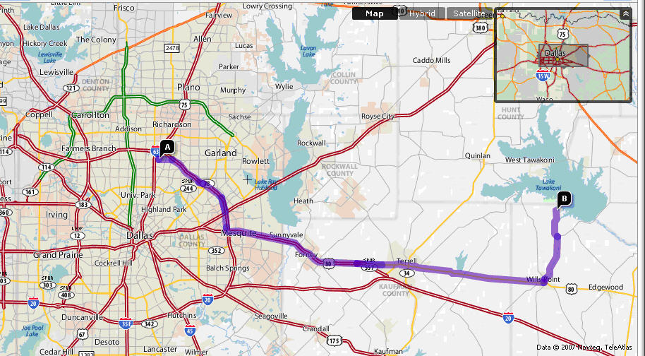
Start at |
|
|
2: |
Turn Left on FOREST LN – go 1.5 mi |
|
|
3: |
Take ramp onto I-635 E – go 4.5 mi |
|
|
4: |
Continue on I-635 S – go 6.0 mi |
|
|
5: |
Take exit #6B/TERRELL onto US-80 E - go 16.1
mi |
|
|
6: |
Take the TERRELL exit onto US-80 E
– go 21.5 mi |
|
|
7: |
Turn Left on |
|
|
8. |
Bear Right to Follow FM-47 – go 5.2 mi |
|
|
9. |
Turn left on FM-2475 – go 3.2 mi |
|
|
10. |
Arrive at 3201 FM 2475, WILLS POINT |
|
|
|
Total Est. Time: 1 hr 8mins (approx.) Total Est. Distance: 58.6 miles
|
Then follow directions to
Directions: The park is
located some 50 miles east of
|
|
|
|
1: |
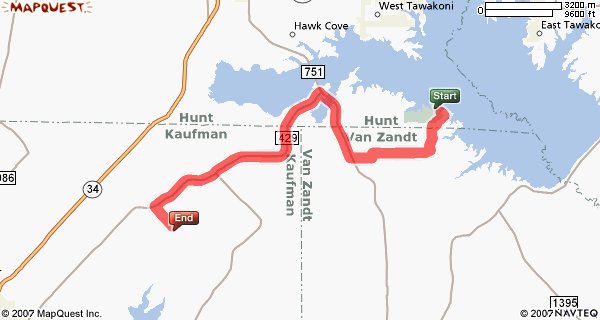
Start out
going SOUTHEAST from State Park |
|
|
|
|
|
First road
out of the State Park.... below |
|
|
|
|
2: |
Turn RIGHT
CR-3810 / |
|
|
|
|
3: |
Turn LEFT
onto CR-3822. |
|
|
|
|
4: |
Turn RIGHT
onto CR-3837. |
|
|
|
|
5: |
Turn RIGHT
onto FM 751 |
|
|
|
|
6: |
Turn LEFT
onto FM 429 |
|
|
|
|
7: |
Turn LEFT
onto |
|
|
|
|
|
End at |
|
|